NYC's 2026 Pedestrian Street Pilots: Data Update
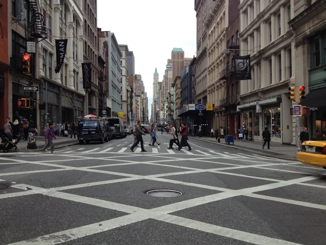
Photo by Mike Petrucci on Unsplash
The city is moving more decisively toward pedestrian-first street pilots NYC 2026, a coordinated set of citywide experiments and programs designed to reclaim public space for people over cars. In late 2025 and early 2026, New York City’s Department of Transportation (NYC DOT) rolled out a structured slate of open-street and car-free events, expanded school-street initiatives, and new sensor-powered pilots to measure how streets are used in real time. The objective, officials say, is to translate safer streets, more vibrant public spaces, and stronger local economies into measurable outcomes. This shift is being framed as a continuum of the Vision Zero and Streets Plan agendas that have guided street design in recent years, with explicit emphasis on pedestrian priority, better accessibility, and community space. The latest announcements, data releases, and pilot opportunities point to a mall-wide effort to test and scale pedestrian-first designs across all five boroughs. (nyc.gov)
The practical upshot for residents, commuters, and local businesses is immediate but nuanced: on days and in corridors where programs like Open Streets and Summer Streets run, pedestrians enjoy larger, car-free or car-reduced spaces that foster walking, shopping, and outdoor activity. At the same time, the city continues to balance these gains with transit reliability, bus service improvements, and safety measures that protect all road users. NYC DOT has highlighted a historic acceleration in pedestrian space, intersection redesigns, and protected bike lanes in recent years, all of which provide a data-driven backdrop for the 2026 pedestrian-first street pilots. In 2024 alone, the agency redesigned thousands of intersections and added hundreds of thousands of square feet of pedestrian space, laying groundwork for the 2026 experimentation phase. (citymeetings.nyc)
Section 1: What Happened
Announcement Details
The city’s 2026 agenda for pedestrian-first street pilots NYC 2026 is anchored by formal, citywide calls for public participation in signature street programs. NYC DOT’s open-streets platform, which transformed street spaces into pedestrian-first public places, opened applications for 2026 partners in October 2025, signaling a renewed push to scale up street activations citywide. The press release confirms the core idea: Open Streets partners—from schools to community organizations to local merchants—will manage street space for a mix of outdoor dining, cultural programming, and community life, while coordinating deliveries and accessibility. This year’s updates also introduce new deadlines and process changes to accommodate a growing field of applicants. For example, the 2026 Open Streets application deadlines include: January 31, 2025 for projects launching in 2026 as Limited Local Access or Full Closure, and new scheduling for School Open Streets with deadlines in January and March 2026. While the exact year notation on the page reflects the 2025 press cycle, the announced framework and the 2026 calendar are active and ongoing, with additional information sessions and online applications available. (nyc.gov)
In early February 2026, NYC DOT expanded the municipal calendar to include a citywide push for Summer Streets and Car-Free Earth Day programming partners for 2026. This call for partners underscores the city’s intent to extend pedestrian-first street pilots NYC 2026 beyond traditional Open Streets corridors into a coordinated portfolio of events that occupy key streets for multiple weekends or one-day signature occasions. The press release confirms dates and deadlines: Car-Free Earth Day submissions due March 6, and Summer Streets submissions due June 26, with dates for future announcements to follow. The program frames these events as essential components of a broader street activation strategy that aligns with the Streets Plan and Vision Zero efforts to reclaim space for pedestrians and public life. (nyc.gov)
Beyond programming events, the city is testing new measurement approaches to quantify street activity and inform design decisions. A Citywide “Street Activity Sensor Pilot,” using Viva sensors, has been placed at 12 locations around the city to capture real-time street-use data. This pilot is part of an ongoing push to ground street redesigns in empirical evidence—information that can steer future improvements toward safer, more comfortable pedestrian environments. The pilot’s existence and scope are documented in NYC DOT’s current-projects listings, which highlight the sensor deployment and its intended use for informing future street redesigns. (nyc.gov)
Timeline and key facts (condensed)
- Oct 22, 2025: NYC DOT announces 2026 Open Streets applications open, with a slate of locations and a list of redesigned corridors for 2026, plus deadlines for school-based Open Streets. This includes examples like 34th Avenue in Queens and Broadway in Manhattan as redesigned corridors under Open Streets. The agency emphasizes safety, accessibility, and community-driven program management. (nyc.gov)
- Feb 5, 2026: NYC DOT issues a call for programming partners for 2026 Summer Streets and Car-Free Earth Day, with deadlines for partner submissions: March 6 for Car-Free Earth Day and June 26 for Summer Streets. The press release positions these events as central to a year of street activations that celebrate pedestrian life across the city. (nyc.gov)
- Citywide sensor pilot: Street Activity Sensor Pilot is deployed citywide (12 locations) to measure how streets are used, providing data to plan future pedestrian-first interventions. This is part of the “Citywide” section of the DOT Current Projects page and aligns with a broader data-driven approach to street design. (nyc.gov)
- 2024–2025 outcomes: The DOT’s own annual Streets Plan update highlights a robust expansion of pedestrian space, completed street redesigns, and an acceleration of the Open Streets footprint. The numbers include 350,000 square feet of new pedestrian space added citywide in 2024, Open Streets expanding from about 7 miles to nearly 20 miles, and a broad interagency push to reimagine street space for pedestrians and public life. These data points provide the baseline for ongoing 2026 pilots. (citymeetings.nyc)
Subsection: Notable pilot corridors and citywide tests
- Major corridor redesigns and completions: The Streets Plan update shows concrete examples of completed or ongoing interventions—like the Broadway corridor and selected avenues in Queens—that broaden pedestrian space and integrate transit and streetscape improvements. These projects demonstrate how pedestrian-first logic is embedded in large-scale street transformations rather than isolated projects. (citymeetings.nyc)
- Citywide sensor experiments: The Street Activity Sensor Pilot adds a quantitative dimension to understanding how pedestrians, cyclists, and motorists share space, enabling better calibrations of future street designs and pilot scopes. This is a model that could influence how pedestrian-first street pilots NYC 2026 are measured and improved over time. (nyc.gov)
Section 2: Why It Matters
Impact on safety, mobility, and everyday life
The core rationale behind pedestrian-first street pilots NYC 2026 is straightforward: safer streets and greater accessibility translate into better everyday life for New Yorkers, while preserving essential mobility. Vision Zero remains a central backbone for these efforts. In the first half of 2025, DOT reported a historic low in traffic deaths, with pedestrian fatalities down 19% versus the same period in 2024. The release emphasizes that a combination of redesigned streets, more pedestrian space, enhanced visibility at intersections through daylighting, and targeted enforcement contributed to this outcome. The data-driven argument is that pedestrian-first street pilots can sustain and broaden these safety gains while expanding access to open streets and public programming. (nyc.gov)

A few key metrics illustrate the scale and momentum behind the pedestrian-first street pilots NYC 2026 agenda:
- Pedestrian space expansion: In 2024, DOT added 350,000 square feet of new pedestrian space citywide, a metric that captures the city’s simultaneous push to widen sidewalks, install curb extensions, and create plazas at high-need intersections. This expansion underpins the feasibility and potential safety benefits of 2026 pilots. (citymeetings.nyc)
- Intersection redesigns and accessibility improvements: The DOT reported redesigning 2,688 intersections in 2024 and installing 885 accessible pedestrian signals. The ramp program also upgraded or installed ramps at more than 9,300 corners, illustrating the agency’s commitment to reliable, accessible pedestrian movement as part of a broader “complete streets” philosophy. These reforms are essential context for why 2026 pilots can be more effective and inclusive. (citymeetings.nyc)
- Open Streets footprint and community impact: Open Streets expanded from roughly 7 miles in earlier years to nearly 20 miles under the current administration, with more than 200 open-street locations annually and substantial involvement by schools and community groups. The expansion is a direct lever for pedestrian-first life—creating weekly gathering spaces that blend commerce, food, culture, and active transport. This scalable urban public-space model is central to the 2026 pilot approach. (citymeetings.nyc)
- Economic and community effects: In the Open Streets framework, corridors become centers of activity that support local businesses, schools, and cultural programming. A DOT press release notes that Open Streets space reallocation can promote economic development and community life by reimagining streets as venues for daily life rather than solely as through-ways for traffic. The policy design emphasizes equity, accessibility, and neighborhood vitality as measurable outcomes. (nyc.gov)
Subsection: Why these pilots matter in the broader policy context The pedestrian-first street pilots NYC 2026 exist within a larger, structured policy architecture. The NYC Streets Plan—and related citywide planning documents—frame street redesign as a long-term, people-first initiative. The plan emphasizes pedestrian safety, protected bike lanes, and more robust bus service as core design targets. The plan’s logic is to convert street space into a more flexible, multimodal public realm, with ongoing evaluation and adjustment based on street-use data. The plan also contemplates open streets as a legitimate, regulated form of street activity that can be scaled in a balanced way alongside New York’s busier corridors. The policy context is essential because it explains why 2026 pilots emphasize data collection, community programming, and a more expansive, equitable distribution of public space. (ibo.nyc.gov)
Subsection: Stakeholder impacts and who gains
- Pedestrians and vulnerable users: The central beneficiaries of pedestrian-first street pilots NYC 2026 are pedestrians, seniors, people with disabilities, and children who rely on safer crossings, daylighted intersections, curb extensions, and more legible street environments. The DOT’s Vision Zero progress highlights the life-saving potential of safer street design and enforcement. The pedestrian-first approach is designed to reduce conflicts and improve crossing experiences across all neighborhoods. (nyc.gov)
- Local businesses and institutions: Open Streets and School Streets initiatives are described by DOT as engines for local commerce and community activity, transforming streets into venues that support outdoor dining, cultural programs, and school-based activities. This is an important dimension for readers to understand how the city’s 2026 pilots aim to balance safety with economic vitality. (nyc.gov)
- Transit riders and bus networks: The policy context notes a parallel emphasis on bus lane expansion and reliable transit service, acknowledging that many pedestrians share streets with buses and cars. Data-driven pilots aim to ensure that pedestrian-first space does not come at the expense of reliable bus operations, a balance underscored by the Streets Plan and related DOT updates. (citymeetings.nyc)
Section 3: What’s Next
Timeline, next steps, and what to watch
The immediate horizon for pedestrian-first street pilots NYC 2026 includes both formal application cycles and measured deployment of pilots. The 2026 Open Streets application window is open with established deadlines for specific program types, and virtual information sessions are available for prospective partners. The existence of the November 2026 information session (as announced in the press release) indicates the city is maintaining an active engagement cadence with community groups and schools, ensuring broad participation and local tailoring of street activations. The official Open Streets page and the DOT press materials are the primary sources for these milestones. (nyc.gov)
Additionally, the city’s focus on Summer Streets and Car-Free Earth Day events expands the calendar and geographic reach of pedestrian-first initiatives. These events create high-impact, high-visibility demonstrations of what pedestrian-first street pilots NYC 2026 can look like in practice, in terms of both urban design and community involvement. The 2026 call for programming partners—along with the art installation RFp process—signals an intent to blend design, programming, and performance art with street safety and mobility goals. The deadlines and processes are documented in the February 2026 press release and associated materials. (nyc.gov)
Near-term milestones to watch
- Street Activity Sensor Pilot results: The city is collecting data from sensors at 12 locations to quantify street activity and inform future redesigns. Watch for year-over-year comparisons and corridor-specific case studies that reveal how people use open streets, crosswalks, and curb spaces during peak hours. The current-projects listing flags this pilot, and DOT will likely publish periodic updates as data accumulate. (nyc.gov)
- Open Streets 2026 application cycle and early deployments: The October 2025 press cycle and the subsequent 2026 planning materials indicate ongoing cycles for partner applications and corridor selections, with updates to deadlines and eligible corridors. Readers should expect corridor rollouts, school partnerships, and the expansion of seasonal or holiday-themed Open Streets events as part of the 2026 calendar. (nyc.gov)
- Summer Streets and Car-Free Earth Day events: The February 2026 DOT release sets dates and submission windows for programming partners, hinting at a more expansive, citywide signature events program. Observers should watch which neighborhoods are selected, the kinds of programming proposed, and how these events integrate with bus lanes and pedestrian plazas along key corridors. (nyc.gov)
What to watch for in 2026 and beyond
- Measuring success and scaling pilots: The Street Activity Sensor Pilot, combined with the Streets Plan’s data-driven approach, suggests that the city intends to scale pilots that prove value in safety, equity, and public life. Expect more granular corridor analyses, more explicit equity metrics, and potentially new funding streams or incentives for communities to pilot pedestrian-first street concepts. The DOT’s ongoing data collection and reporting will be central to this evolution. (nyc.gov)
- Policy integration and funding: As the city expands the Open Streets program and orientates more corridors toward pedestrian-first concepts, more attention will fall on balancing street activations with transit service and freight operations. The Streets Plan and Vision Zero frameworks will continue to guide these decisions, ensuring that pedestrian-first interventions are designed to be compatible with bus service, emergency access, and essential deliveries. Officials have signaled a willingness to adapt rules and processes to accommodate more community-led, data-informed street activations. (ibo.nyc.gov)
Closing
As Manhattan and the other boroughs begin to execute these pedestrian-first street pilots NYC 2026, readers should expect a city that more openly tests, measures, and refines street designs that prioritize pedestrians, seniors, children, and people with disabilities. The combination of Open Streets expansions, Summer Streets activations, and new sensor-based data collection creates a framework in which pedestrian-first design is not a one-off policy tweak but a systematic, data-driven approach to urban mobility and public space. The numbers from the DOT’s 2024–2025 reporting period illustrate what is possible when street design is coupled with community programming and rigorous measurement. The city’s ongoing emphasis on safety, equity, and accessibility remains central to these efforts, and it will take time to see how the 2026 pilots translate into longer-term improvements for all New Yorkers.
For residents and stakeholders seeking to stay informed, official NYC DOT channels remain the most reliable sources: Open Streets pages, Summer Streets program pages, and DOT press releases offer the latest deadlines, corridors, and program updates. In addition, organizations involved in community planning and Streets Plan updates—like City Council reports and local transportation committees—provide context on how these pilots fit into the city’s broader mobility strategy. As with past cycles, the success of pedestrian-first street pilots NYC 2026 will depend on consistent funding, broad participation, and ongoing evaluation that translates data into concrete improvements for the city’s streets and public spaces. Watch for 2026 and 2027 progress reports, corridor-by-corridor analyses, and the next wave of public-facing activations that will define how New York City moves in the years ahead. (nyc.gov)