New York City Greenway Network Expansion 2026: Data Update
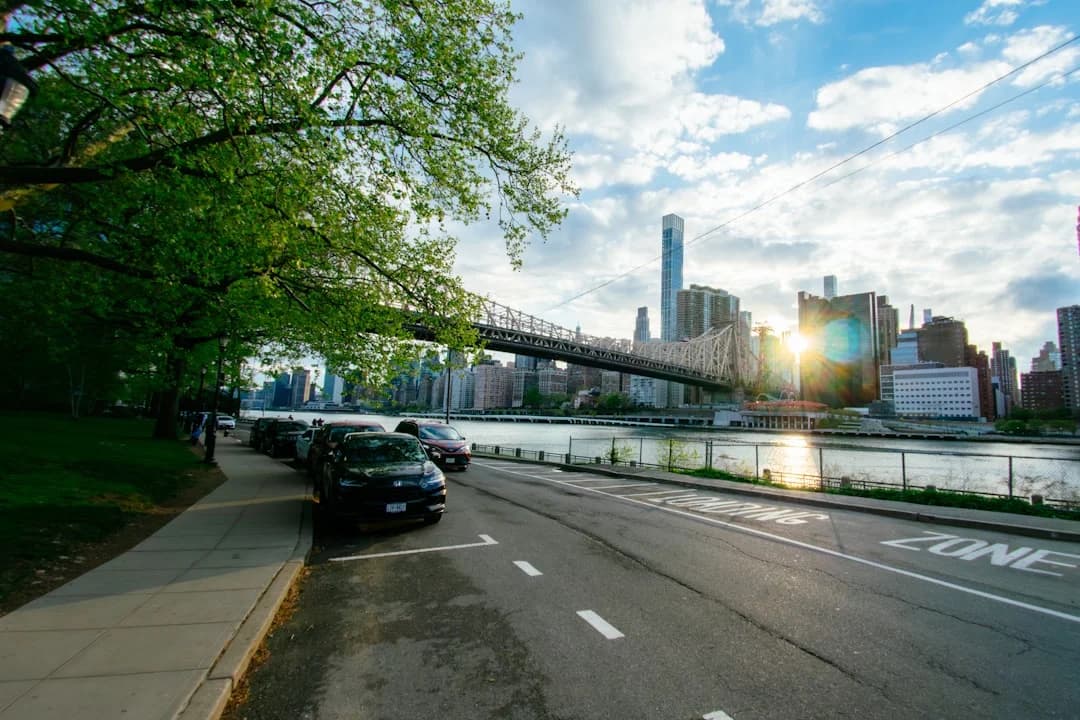
Photo by Dongsh on Unsplash
New York City is accelerating its greenway ambitions with the New York City Greenway Network Expansion 2026, a data-informed, cross-agency effort designed to connect neighborhoods, parks, and waterfronts with safer, pedestrian- and bike-friendly routes. The collaboration among NYC DOT, NYC Parks, and the Economic Development Corporation (EDC) released a citywide plan in 2025 that maps out a bold expansion of the greenway network across all five boroughs. Officials say the expansion aims to close long-standing gaps in the system, increase access to parks and commercial corridors, and bolster climate resilience by offering healthier, low-emission travel options for residents and visitors alike. This plan comes at a moment when New York City’s mobility and environmental goals are increasingly intertwined with economic development and equitable access to public spaces. The New York City Greenway Network Expansion 2026 is already shaping how neighborhoods envision travel, commerce, and recreation, with near-term actions feeding into a longer-term transformation of the city’s waterfronts and streets. (nyc.gov)
The Greater Greenways plan, unveiled on August 13, 2025, marks the first comprehensive citywide greenway strategy in more than three decades. City officials described it as a blueprint to expand and connect the existing 506 miles of greenways into a more cohesive network, prioritizing underserved communities and prominent corridors that link housing, schools, and employment centers to parks and waterfronts. The plan emphasizes closing current gaps, integrating greenways with future transit and street improvements, and advancing the city’s broader commitments to climate action and safer streets. As of early 2026, the city has continued implementing the plan through a mix of design, construction, and community outreach, with a focus on translating maps and planning documents into real-world improvements. (nyc.gov)
In the Bronx, Manhattan, Brooklyn, Queens, and Staten Island, early win-wows from the Greater Greenways rollout include completed or redesigned sections that demonstrate how the plan translates into tangible streetscape upgrades. A notable milestone occurred in 2025 with the Harlem River Greenway improvements, including the Bailey Avenue redesign between Van Cortlandt Park South and West 225th Street, delivering new protected bike lanes, pedestrian safety features, and better bus and pedestrian connectivity. The project is part of a broader push to reimagine major corridors as fully integrated greenways rather than solely as transit routes. This Bronx achievement underscores the plan’s aim to connect outer-borough communities to the Harlem River Greenway and other regional greenway strands, expanding access to healthier travel options and local amenities. (nyc.gov)
What Happened Announcement and scope
-
The Greater Greenways: NYC Greenway Plan was released on August 13, 2025, by NYC DOT in partnership with NYC Parks and NYCEDC. The release framed the plan as a citywide, long-term expansion of the greenways network, with a stated goal of closing gaps, boosting access to waterfronts and parks, and enhancing safety and climate resilience. The plan is positioned as the first such comprehensive citywide effort in more than 30 years, reflecting a broad, multi-agency approach to urban mobility and public space. (nyc.gov)
-
The plan builds on a historic baseline: NYC currently boasts about 506 miles of existing bicycle and pedestrian corridors, a figure the Greater Greenways plan maps against and seeks to extend through targeted corridors and new linkages. The document and accompanying materials outline a phased approach to grow the network, with an emphasis on equity and access for communities historically underserved by green infrastructure. (nyc.gov)
Key corridors, projects, and immediate actions
-
The plan highlights outer-borough corridors and waterfront opportunities as priorities for near-term development. In concert with ongoing public engagement, the plan identifies locations where new greenways can be built or expanded to stitch together neighborhoods with safer routes to schools, transit hubs, and employment centers. Public workshops and updates have been part of the rollout, with the city encouraging residents to review route concepts and provide input. This emphasis on public involvement is noted on the city’s greenways portal and related project updates. (nyc.gov)
-
In addition to planned linkages, the city has already advanced specific projects that illustrate the expansion logic. The Harlem River Greenway implementation, completed in 2025, redesigned Bailey Avenue to include two-way protected bike lanes, pedestrian islands, bus boarding islands, and other safety features. This work demonstrates the plan’s intent to retrofit existing corridors to meet modern safety and accessibility standards while enabling better regional connections to the Harlem River Greenway and adjacent routes. (nyc.gov)
-
The Brooklyn Waterfront Greenway and Queens Waterfront Greenway components are among the high-profile corridors currently being advanced as part of the multi-agency effort. The current-projects page from NYC DOT details the ongoing work on these waterfront segments, including corridor-wide improvements, route alternatives, and community engagement components. These efforts corroborate the plan’s emphasis on creating a continuous greenway network that spans both on-street and off-street routes, connecting residential neighborhoods with economic and cultural assets along the water. (nyc.gov)
-
In early 2026, design activity around select corridors continued, with proposals for protected bike lanes and street treatments discussed for specific Manhattan and outer-borough segments. For example, NYC DOT’s proposed 72nd Street protected bike lane project reflects the city’s broader strategy to deploy protected lanes across key arterial corridors, strengthening connections between Central Park, the Hudson River Greenway, and adjacent neighborhoods. Fall 2026 is noted as a target for presenting these design proposals to affected Community Boards, signaling ongoing progress toward the plan’s near-term milestones. (nyc.gov)
-
The Greater Greenways plan and supporting materials stress a multi-year, phased implementation timeline that includes early-action corridors, ongoing design work, and eventual construction across multiple boroughs. The public-facing materials indicate an intent to sustain momentum through 2026 and beyond, with continued coordination among DOT, Parks, and EDC, as well as input from community boards and residents. The plan also provides a mechanism for ongoing updates and revisions as projects move from map to street. (nyc.gov)
Section 1: What Happened (summary of key facts and timeline)
-
August 13, 2025: Greater Greenways plan released, establishing a citywide blueprint for expanding and connecting greenways across NYC. The plan positions greenways as essential mobility infrastructure and climate resilience assets, with explicit emphasis on closing gaps and expanding access to underserved communities. (nyc.gov)
-
2025–2026: Implementation activities underway, including completed Harlem River Greenway improvements (Bailey Avenue redesign) and ongoing work on Brooklyn and Queens waterfront corridors. The outer-borough expansion is a central focus, aligning with the plan’s goal of increasing the overall mileage of safe, accessible greenways beyond the existing 506 miles. (nyc.gov)
-
2026: Near-term actions include design proposals for additional protected bike lanes and greenway improvements, such as the 72nd Street project in Manhattan, with Community Board reviews planned in fall 2026. This illustrates a tangible shift from planning to construction in selected corridors as part of the multi-year expansion. (nyc.gov)
-
Public engagement and ongoing updates: The city’s greenways portal and DOT project pages indicate a continuing series of public workshops and route reviews, ensuring that plans reflect local needs and concerns while expanding the network. (nyc.gov)
Section 2: Why It Matters
Mobility, safety, and climate resilience

- The Greater Greenways plan frames the expansion as a strategy to improve mobility options and safety for New Yorkers, with a focus on protecting vulnerable users and reducing vehicle conflicts along major corridors. The emphasis on protected bike lanes and safer street designs aligns with the city’s Vision Zero goals and broader climate objectives, positioning the greenway network as a core component of a safer, more sustainable urban mobility system. The plan’s leadership statements highlight access to parks, waterfronts, and commerce as economic and quality-of-life benefits tied to safer, low-emission travel options. (nyc.gov)
Equity and access
- A central theme of the Greater Greenways plan is closing gaps to ensure that all five boroughs—and especially underserved neighborhoods—gain access to high-quality greenways. The city’s messaging emphasizes equitable distribution of green infrastructure, with outer-borough corridors prioritized to reduce travel inequalities and boost access to parks, recreation, and employment opportunities. Public officials stress that the network’s expansion is not just about miles of paths but about connecting residents to everyday destinations in safer, healthier ways. (nyc.gov)
Economic and community impact
- Beyond mobility and safety, planners foresee economic benefits tied to enhanced access to waterfronts and parks. Greenways can support local businesses by increasing foot traffic and creating scenic corridors that attract visitors for recreation and commerce. The Greater Greenways plan positions greenways as economic drivers by linking residential areas with amenities and by supporting active transportation as a backbone for neighborhood vitality. These assertions are echoed by NYC DOT’s public communications and related coverage in local outlets. (nyc.gov)
Technology, data, and market trends
-
The Greenway expansion is being characterized as a data-driven, cross-agency project that uses mapping, route optimization, and safety data to guide investments. The plan explicitly maps existing miles and identifies opportunities to build new paths and improve connections, reflecting a broader trend toward urban infrastructure that blends mobility, environmental sustainability, and digital planning tools. The documentation and supporting materials emphasize a coordinated, citywide approach rather than ad hoc projects, signaling a shift toward more scalable, replicable greenway development practices. (nyc.gov)
-
In the broader context of mobility technology, the expansion aligns with a growing emphasis on protected bike lanes, smarter street design, and better data transparency around project timelines and impacts. For instance, planned protected lanes and corridor upgrades are being discussed in public forums and design reviews as part of the ongoing iteration of the plan, indicating a market-ready posture for urban mobility technology adoption, public-private collaboration, and the use of street design as a lever for resilience and economic activity. (nyc.gov)
-
Critics and observers point to the need for robust maintenance funding and ongoing governance to ensure that new greenways do not degrade over time. Streetsblog and other local outlets note that while expansion offers many benefits, the long-term success of a citywide greenway network depends on sustained investment in maintenance, safety improvements, and equitable access to programs that support users of all ages and abilities. This emphasis on stewardship and service levels is an important counterweight to the optimism around miles added and corridors opened. (nyc.streetsblog.org)
Section 3: What’s Next
Near-term actions and design work
-
The near-term actions for 2026 center on advancing design plans and moving from concept to construction in selected corridors. The 72nd Street protected bike lane project in Manhattan illustrates this progression, with a design proposal slated for Community Board 8 in fall 2026. The project underscores the plan’s reliance on protected lanes to connect key destinations, including Central Park and the Hudson River Greenway, while contributing to Vision Zero objectives. As with other corridors, community input will shape the final design. (nyc.gov)
-
Ongoing public engagement and transparency are integral to the rollout. The DOT’s current projects page highlights the Brooklyn and Queens waterfront routes, including route alternatives and public workshop opportunities. These steps help ensure that the rapid planning and construction work reflects local needs and preferences while aligning with the city’s broader greenway strategy. (nyc.gov)
Funding, oversight, and partnerships
-
The Greater Greenways plan explicitly relies on multi-agency collaboration and a mix of funding streams, reflecting a broader municipal finance framework that includes city budgets and targeted state and federal funds. The plan’s emphasis on closing gaps and expanding access across diverse communities implies that multi-year funding commitments will be critical to sustaining momentum through 2026 and beyond. City communications place these investments within the city’s climate resilience and economic development strategies. (nyc.gov)
-
Public-private partnerships and anchor institutions are expected to play a role in the plan’s implementation, given the scale of the corridors and the waterfronts involved. The Greenways Coalition and related advocacy groups emphasize implementing a cohesive, citywide strategy and coordinating with state networks to maximize leverage and alignment with regional trails. This ecosystem of partners helps translate the plan’s maps into executable projects and ensures accountability through ongoing performance metrics. (greenways.nyc)
What to watch for in the coming months
-
Construction milestones and corridor detours: As projects move from design to construction, readers should watch for specific milestones announced by NYC DOT and NYC Parks, including updated project schedules, detour notices, and safety improvements on busy corridors like the waterfronts and major north-south routes. The NYC DOT current projects page provides a live view of corridor status and upcoming public engagement opportunities. (nyc.gov)
-
Additional policy and equity actions: The city’s ongoing governance around green spaces and trails may include new policies or programs to improve access in underserved neighborhoods, expand green canopy, or enhance maintenance regimes. The city has signaled a broader commitment to green space expansion and climate resilience as part of Earth Week initiatives and related policy packages, which could influence funding and project scoping for Greenways in 2026 and beyond. (council.nyc.gov)
-
Alignment with broader infrastructure programs: The Greenways expansion sits alongside other mobility and waterfront initiatives, including bus rapid transit concepts, bike-share expansion, and street redesigns. Observers should monitor how these programs intersect with the greenway corridors to create a more seamless citywide transportation and recreation network. The city’s public communications and project updates emphasize this integrated approach to urban mobility and public space development. (nyc.gov)
Closing
The New York City Greenway Network Expansion 2026 represents a bold, data-driven step toward a more connected and accessible city. By mapping existing miles, identifying gaps, and pursuing targeted, equity-centered expansions across all five boroughs, the plan seeks to turn long-standing waterfront and corridor ambitions into concrete daily realities for residents and visitors. With 2026 marking a pivotal year for design approvals, construction milestones, and ongoing community engagement, New Yorkers can expect a staged but steady evolution of the city’s walking and biking network. The expansion will also test the city’s capacity to align mobility, climate resilience, and economic development in real time, creating new opportunities for local businesses, healthier neighborhoods, and safer streets. Stakeholders say the effort is not simply about adding miles but about building an enduring, adaptable infrastructure that serves diverse communities and strengthens New York City’s role as a leader in urban greenway planning and sustainable mobility. For residents eager to learn more or weigh in on specific corridors, city channels and the Greenways portal remain the best starting points for up-to-date information and opportunities to participate in the ongoing process. (nyc.gov)

As the city continues to refine its approach, observers from planning firms, community boards, and neighborhood groups will be closely watching early corridor implementations to gauge how well the 2026 expansion translates into safer streets, more accessible parks, and tangible economic benefits along waterfronts and in transit-rich neighborhoods. The New York City Greenway Network Expansion 2026 is not a single project but a citywide movement toward a more walkable, bike-friendly, and climate-resilient metropolis, built on a shared commitment to open, well-maintained routes that connect people to opportunity and to each other. (nyc.gov)